
Knockeirka [Cnoc Adhairce]
Good walks are even better shared.
Overview
Knockeirka [Cnoc Adhairce]
Knockeirka, or Cnoc Adhairce, is a striking feature of the County Kerry mountains. Standing at an elevation of 501 meters, it may not claim the title of the tallest peak, but what it lacks in height it more than makes up for in breathtaking views and enchanting scenery.
Geology
This mountain is primarily composed of Old Red Sandstone, a feature that gives the landscape its rugged appearance. The erosion over thousands of years has sculpted its slopes into a dramatic vista.
Routes
Glen fincaul Route
The preferred approach is the Glen fincaul route, which spans approximately 8.0 km and usually takes about 3.5 hours to complete. The trail meanders through picturesque valleys and glens filled with vibrant flora, making for both a visual treat and a pleasant hike.
Summit Features
On reaching the summit, hikers are greeted by a modest cairn that signals their achievement. The panoramic views from here are simply magnificent, showcasing the Dingle Peninsula and beyond on clear days.
Terrain Type
Prepare for a mix of rocky and grassy trails with some sections that may become slippery following rain. Appropriate footwear is recommended to ensure stability.
Views
Highlights from the summit include sweeping views over the countryside, with spectacular glimpses of the Macgillycuddy's Reeks to the east. To fully appreciate the beauty of the landscape, spring and early autumn provide the best vantage points, often illuminating the hills in breathtaking colours.
Hazards
Hikers must be cautious of slippery rocks, particularly after rainfall, and remain aware of the shifting weather conditions that can change rapidly. Fog can roll in without warning, so always ensure you have a reliable map and navigation tools.
Nearby Summits
If you're feeling adventurous, nearby peaks include Carn Druid and Knockanaguish, both offering additional hiking opportunities and stunning views.
Access
To get to Knockeirka, the nearest parking is conveniently located at the Glen fincaul trailhead. For those relying on public transport, local bus services do connect Tralee to the surrounding villages; however, check the schedules to avoid being left in the lurch! Sneem, just 10 km away, is the nearest town, boasting a few cafés and essential facilities.
History
The name Cnoc Adhairce, or 'Hill of the Hares', hints at a time when these furry creatures were abundant here. The mountain is steeped in local folklore and holds a place in the hearts of the community.
Whether you're a seasoned hiker or just fancy a stroll with some delightful views, Knockeirka is a treasure just waiting to be explored. Make sure to pack your camera, your sense of adventure, and perhaps a snack or two — you wouldn't want to lose your head up there!
Explore routes near Knockeirka [Cnoc Adhairce]
Public walks starting within 80 km of this hill. Nearby does not mean a route reaches the summit; check its map and access before setting out.
No public routes are currently listed within 80 km of Knockeirka [Cnoc Adhairce] on Walkmates. This does not mean there are no paths here. Explore the map and check local access information before planning a walk.
Route planning notes
These notes describe possible approaches, not verified navigable routes or permission to cross land. Check current paths, local access rules and conditions before setting out.
Glen fincaul Route
A popular approach from the Glen fincaul trailhead that winds through scenic valleys and lush greenery, leading up to the summit.
Make a day of it, together
Find someone to share the walk with, or organise a day out along a route you like.
Hill facts and local notes
Classifications
Elevation
426m
1,398 ft
Prominence
184m
Coordinates
51.8419, -9.5533
V930666
OS Map
85
At the Summit
The summit features a modest cairn with stunning panoramic views of the surrounding countryside, and on a clear day, the distant peaks of the Macgillycuddy's Reeks are visible.
Terrain & Geology
Primarily composed of Old Red Sandstone, Knockeirka's rugged slopes and distinctive cliff faces offer a fascinating example of erosion and geological processes at play in the region.
Views & Scenery
Stunning views of the Dingle Peninsula to the south, and the rolling hills of County Kerry in every other direction.
History & Heritage
Name Origin
Cnoc Adhairce translates to 'Hill of the Hares', pointing to the field-dwelling critters that once roamed these slopes.
Historical Significance
Knockeirka has been a local landmark for generations, often featuring in folklore and community tales; it remains a favourite for locals and hikers alike.
Getting There & Facilities
Check current local access restrictions, parking rules and transport timetables before travelling. These notes do not confirm public access to the summit.
Parking
There is a car park at the Glen fincaul trailhead, which can accommodate a reasonable number of vehicles. Arrive early during peak times to secure a spot.
Public Transport
Local bus services run from Tralee to nearby villages, but it’s advisable to check the schedule as services can be infrequent.
Nearby Facilities
There are a few cafes and shops in Sneem, along with public toilets that can be essential before starting your hike.
Safety Information
Known Hazards
- Slippery rocks, variable weather conditions, and potential for fog.
General Safety Tips
- Check weather conditions before setting out
- Carry appropriate clothing and equipment
- Let someone know your planned route
- Take a map, compass, and GPS device
- Carry emergency supplies: food, water, first aid kit, torch
Hills
Some common questions about the hills answered
Are there group walks up Knockeirka [Cnoc Adhairce]?
Many walkers use Walkmates to join or organise walks with others. You can check for group walks around Knockeirka [Cnoc Adhairce] through the maps
Are there other walkers around Knockeirka [Cnoc Adhairce]?
Activity varies by location and time, but Walkmates lets you see whether others have shared walks or shown interest in this area. Find other people through the walking friends search walking friends for Knockeirka [Cnoc Adhairce] search or of course create your own walk for Knockeirka [Cnoc Adhairce]
Can I organise a walk to Knockeirka [Cnoc Adhairce]?
Yes. If there aren’t any walks listed already, you can create a walk and make it available for others to join.
If you're signed up to Walkmates, you can create a walk to Knockeirka [Cnoc Adhairce].
How do I find a walk up this hill?
There are often multiple ways to walk this hill, depending on experience and route preference. Walkmates helps you explore walks and routes that others have shared.
Can I suggest a new route up Knockeirka [Cnoc Adhairce]?
Yes. You can suggest or create routes to share with others. Walkmates focuses on the social side of walking, so routes are used to help people organise walks and explore areas together, rather than as detailed navigation tools or route libraries.
Other uses really appreciate knowledgeable walkers sharing their routes. Share your favourite route to Knockeirka [Cnoc Adhairce] here
The is an error or something incorrect about this hill. How do I let you know?
We always strive to keep the information on Walkmates as accurate as possible. If you find an error, please let us know through the contact form and we'll aim to correct it as quickly as possible
Community Discussion
Comments
Location
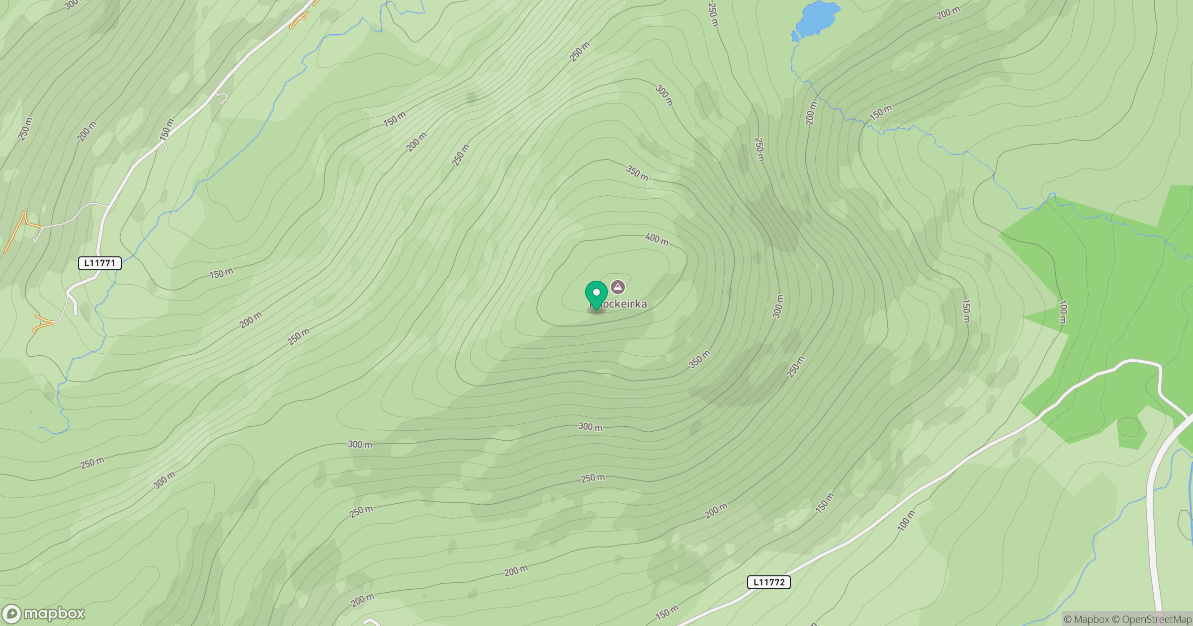
Grid reference: V930666
View on OpenStreetMapOpens a map in a new tab, centred on the hill.
Hills within 30 km
Straight-line distance, not a walking route or confirmation of access.
Torc Mountain
535m
Carrauntoohil
1,039m
Killaha Mountain [Sliabh Choill Atha]
405m
Inchimore
256m
Knocknagorraveela [Cnoc na gCorrmhiolta]
507m
No comments yet. Be the first.